Read update
- New Additions To The Article: Tackle More Of The Scariest Hikes In America
Summary
- Key takeaways:
- Hiking in America's most dangerous trails requires bravery and understanding of the risks involved.
- These treacherous hikes boast stunning views and are best suited for experienced adventurers.
- Factors such as steep cliffs, extreme weather, and wild animals make these hikes not suitable for novice hikers.
Hiking sounds challenging for novice adventurers, but for mountaineers and trail runners, it is the weakest form of outdoor sport. The thrill of it all, the adrenaline, the sense of satisfaction, and being able to see spectacular views that only a few souls are able to see are why these adventurers continue to embark on these dangerous journeys.
But the difference is an adventure to America’s greatest heights is not for the faint-hearted. At the end of these hikes are great risks, and only the bravest can tackle these intimidating trails that the US has to offer, some of which are among the world's most dangerous hikes.
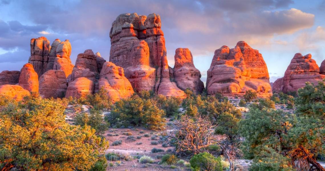
Narrow trails, cliff sheers, extreme weather conditions, deadly water currents, and wild animal encounters sum up the possible experiences that one of these trails possesses. That is why these notorious hikes are definitely not for novice hikers. Here is the list of the most dangerous hikes in the US, which are best tackled once hikers understand the dangers of hiking such trails.

These Are The 13 Most Dangerous Hikes In Canada
These trails offer all the rewards that come with an exciting hike but to get these rewards; one will have to overcome a couple of extreme challenges.UPDATE: 2023/10/30 17:01 EST BY ALICIA REMMY
New Additions To The Article: Tackle More Of The Scariest Hikes In America
We've updated this list with two more of the most dangerous trails in the US that aren't for the faint-hearted. The article also contains other valuable insights like the trail's length, how long it takes, elevation gain, and more to help experienced hikers plan accordingly. These dangerous hikes in the US can be nerve-wracking and heart-pounding, but they promise views that only a few have seen. Have fun!
16 Half Dome via the John Muir Trail (JMT), Yosemite National Park, California

Although well-marked and a favorite for avid hikers, the Half Dome Trail is one of the most exciting yet dangerous hikes in the United States. Adventurers endure the consistent elevation gain, conquer steep switchbacks, and walk across a rocky surface to the base of the famed cables. Here, hikers start the steep and dangerous ascent to Half Dome with the support of two metal cables, proceeding carefully to avoid serious injuries or even falling to their deaths. The reward of embarking on this arduous adventure is the views of Vernal and Nevada Falls along the way and Yosemite Valley and the majestic High Sierra at the summit.
- Distance: 14–16 miles
- Hiking time: up to 12 hours
- Difficulty level: Hard
- Elevation change/gain: 4,800 feet
- Best time to hike: May through October
15 Precipice Trail, Acadia National Park, Maine

Another risky yet one of the most beautiful hikes in the US is Precipice Trail in the Acadia National Park. Although the actual trail is not super challenging to finish, the cliffs and slippery conditions make this one a bit more dangerous. Considering the Precipice Trail is one of Maine's most popular, this often leads locals to worry about someone falling and becoming injured.
According to the National Park Service, this trail requires mental and physical strength and rises over 1,000 feet in 0.9 miles. Precipice Trail in Maine is not one for newbies and may even be intimidating for lifelong nature enthusiasts.
- Distance: 3.2 miles
- Hiking time: 3 hours
- Difficulty level: Hard
- Elevation change/gain: 1,060 feet
- Best time to hike: May through October
It's best to stay on the path, avoid hiking near the edge, and tackle this trail during inclement weather.
14 The Maze, Canyonlands National Park, Utah

As one of the least accessible portions of Canyonlands National Park, The Maze Trail is often considered to be the park's most dangerous route. According to the National Park Service, visitors to this trail should be prepared with self-rescue equipment in the event local authorities aren't able to access them in time.
Besides the remote location, The Maze also requires people to access it via a high-clearance, four-wheel-drive vehicle. Without a properly equipped car, travelers to The Maze may find themselves trapped. This isn't a super hard trail once someone arrives, but the journey to and from is risky. The rocky, uneven terrain is also something to watch for, especially for older and young hikers.
- Distance: 8 miles
- Hiking time: 3 hours 20 minutes
- Difficulty level: Hard
- Elevation change/gain: 965 feet
- Best time to hike: Spring and fall
13 The Presidential Traverse, White Mountain National Forest, New Hampshire

The Presidential Traverse demands a high level of preparedness due to its exposure, long distance, and extreme weather possibilities. Adventurers risk prolonged high winds and low temperatures exposure, even when hiking during the warmer months.
Despite the danger, hikers enjoy observing the diverse flora and fauna as they bag bragging points for climbing several peaks in a short time. This grueling hike takes experienced hikers to the summits of Mount Madison, Mount Washington, Mount Adams, and Mount Jefferson, to name a few.
- Distance: 18 miles
- Hiking time: up to three days
- Difficulty level: Hard
- Elevation change/gain: 8,182 feet
- Best time to hike: May through September
12 The Kalalau Trail, Kauai, Hawaii

Another dangerous trail in the United States is the Kalalau Trail along the Na Pali Coast of Kauai. This is considered Hawaii's most dangerous hiking trail, as it takes people along steep cliffs, rocky terrain, and slippery conditions throughout the year. Because of its water-adjacent location, this hiking trail is often wet and can be incredibly risky for travelers to maneuver. Oddly enough, this trail is often deemed the most beautiful in the US as well, hence why so many people try to accomplish it.
- Distance: 11 miles
- Hiking time: 12 hours 30 minutes
- Difficulty level: Hard
- Elevation change/gain: 6,512 feet
- Best time to hike: May through October
Many hikers experience unstable terrain on their walk because of the nearby eroding cliffs that make up large chunks of this trail. This can result in injury or even death, so avid hikers should be cautious and stay far away from the edge.
11 Mist Trail, Yosemite National Park, California

Standing at 4,000 feet (1,200 meters), Mist Trail is the signature hike at Yosemite National Park in California. It comprises two spectacular falls, Vernal Falls and Nevada Falls, which are 900 feet tall combined. Hiking time runs between two and five hours, depending on how far a hiker goes. At the top is the striking view of Nevada Falls, the Liberty Cap, and the back of Half Dome from Muir Trail.
As one of the more dangerous hikes in the country, hikers should prepare for the danger it promises. It is not the cliffs or the waterfalls that cause deaths; it’s the river current. It might look less dangerous, but it has caused hikers to slip through its current and be swept into a deadly stream.
- Distance: 6.4 miles
- Hiking time: 4 hours 10 minutes
- Difficulty level: Hard
- Elevation change/gain: 2,208 feet
- Best time to hike: May through October
10 Bright Angel Trail, Grand Canyon National Park, Arizona

Bright Angel Trail has an elevation of 6,850 feet with a depth of 4,350 feet. Despite available water stations along the way, there are still around 250 people being rescued from the Canyon every year. With its many destination points, being guided by bodies of water, it is dangerous for hikers. Moreover, this trail is not advisable for a one-day trek; some people camp out at the peak and head down the next day to avoid accidents.
Wild animals can be encountered along the way as well, so it is important to learn some safety precautions before heading on the hike to avoid human and animal injuries.
- Distance: 15.3 miles
- Hiking time: 8 hours
- Difficulty level: Hard
- Elevation change/gain: 6,850 feet
- Best time to hike: Fall and spring
9 Camp Muir Snowfield, Mount Rainier National Park, Washington

Camp Muir Snowfield Trail requires ample preparation, including how to choose a hiking pack. With its rapidly changing weather and challenging vertical climb, this trail is very dangerous. With an elevation of 2,800 vertical feet, hikers should pay attention to warnings and cautions along the way. Anyone who plans to visit this trail should prepare food, water, and equipment for an ice trek.
With an altitude as high as this hike, many accidents have happened, even during summer. Mountaineers have died and frozen trying to reach the summit. But those who make it to the top get to enjoy the view of Mt. Rainier, the glaciers, and the tall seracs.
- Distance: 8.8 miles
- Hiking time: 8 to 10 hours
- Difficulty level: Hard
- Elevation change/gain: 4,640 feet
- Best time to hike: June through September
8 Mt. Washington Trail Peak, New Hampshire

Mt. Washington is the highest mountain on the northeastern side of the country. The trail leading to the summit stands with an elevation of over 6,288 feet, making it one of the most dangerous hikes in the U.S. It is popular for its weather extremities, with the highest wind recorded at 231 miles per hour.
Despite the risks of weather conditions, it is still one of the most popular tourist destinations in the state. This challenge requires splendid workouts and physical training to avoid any injuries along the way.
- Distance: 8.2 miles
- Hiking time: 9 hours
- Difficulty level: Hard
- Elevation change/gain: 4,186 feet
- Best time to hike: June through October
7 Barr Trail, Manitou Springs, Colorado

Colorado may be home to beautiful hikes that one can take in the fall, but it also houses a strenuous hike that's only suitable for experienced and daring hikers. Barr Trail, also known as Pikes Peak, is one of the most difficult hikes in the region and around the United States.
Just like Mt. Washington, this trail is a 12-mile trek to the top that can take from six to ten hours, depending on how experienced a hiker is. With an elevation of over 7500 feet, it is definitely not an easy peak to trek. However, a breathtaking view of Manitou Springs and Pikes Peak makes the hassle worth it.
- Distance: 12 miles
- Hiking time: 10 hours
- Difficulty level: Hard
- Elevation change/gain: 7,460 feet
- Best time to hike: May through October
6 Angel’s Landing, Zion National Park, Utah

With an average of two deaths every year, Angel’s Landing is one of the more dangerous hikes in Zion National Park. This challenging hike is 1000 feet with narrow trails in some areas. Hence, it has bolted chains that serve as handholds for hikers.
Even with the safety measures, it's still nerve-wracking looking at its sheer cliffs. But at the peak of this trail is a magnificent view and a chance for hikers to dangle their feet over the cliffs, which is an exhilarating reward for those who dared to hike Angel’s Landing.
- Distance: 5.4 miles
- Hiking time: 4 hours
- Difficulty level: Hard
- Elevation change/gain: 1,488 feet
- Best time to hike: March to October
5 Devil’s Path, Catskill Mountains, New York

Many tourists may know New York for its high-rise buildings that beautify New York City and other cities, but the state is also an outdoor lovers' playground. The Devil’s Path in Catskills is the most underrated hike in the country, including Catskill’s seven peaks; combined, it has a grueling height of 14,000 feet. With such a dangerous trek, a 25-mile gorgeous sight awaits at the top. Its steep and vertical climbs cause regular accidents and rescues every year.
- Distance: 21.9 miles
- Hiking time: 15 hours
- Difficulty level: Hard
- Elevation change/gain: 8,123 feet
- Best time to hike: May to October
4 Abrams Falls Trail, Great Smoky Mountains, Tennessee

This 5-mile trek is one of the shortest hikes out of all the dangerous hikes in the country. It has an approximate 1,800 feet of elevation with a very deadly water current. More than the risky trail, the Abrams is a historic fall named after the Cherokee Indian Chief Oskuah, who changed his name. The top of the Abrams Falls trail offers many scenic views, including the spectacular Great Smoky Mountains.
- Distance: 5 miles
- Hiking time: 2 hours
- Difficulty level: Hard
- Elevation change/gain: 617 feet
- Best time to hike: Spring and Fall
3 Maroon Bells South Ridge, White River National Forest, Colorado

Hiking Mount Huashan may be the most dangerous hike in the world, but the Maroon Peak Trail is another extremely challenging route that even the most experienced hikers shouldn't take lightly. At the peak of this 14,000-foot hike is a stunning view of the Rocky Mountains, White River, and Maroon Lake. Because of its distinctive colors, many daring hikers do not miss trekking the area to get a photo of its fall colors aspen trees.
- Distance: 10.9 miles
- Hiking time: up to 12 hours
- Difficulty level: Hard
- Elevation change/gain: 4,950 feet
- Best time to hike: March through September
2 Capitol Peak Via The Knife Edge, Colorado

Near Aspen, in the Elk Range, Capitol Peak is a classic mountain dominating the horizon. However, it's also one of the most dangerous and most exposed peaks in the United States. For instance, the Elk Range has the most challenging, highest, and most charming mountains in Colorado. The sharp blade of granite rock that is 150 feet long is the Knife Ridge, the most infamous section of the Capitol Peak hike. It also has a drop-off of over 1000 feet on both sides and is not for the inexperienced or the faint of heart.
The hike is 15.9 miles round-trip from the Capitol Creek Trailhead. It has 5,300 feet of elevation gain. Many people try to complete the hike in two days. While it's possible to do so, they will need to have climbing, hiking, and scrambling experience to safely achieve their objective.
- Distance: 15.9 miles
- Hiking time: Up to two days
- Difficulty level: Hard
- Elevation change/gain: 5,300 feet
- Best time to hike: July through September
1 Huckleberry Trail, Glacier National Park, Montana

Backpackers have to take precautions to stay safe in Glacier National Park since it has the highest grizzly bear population density in the Lower 48. This includes Huckleberry Mountain, which has a thriving grizzly habitat. During peak berry season, the National Park Service closes the Huckleberry Trails to protect tourists from the bears that come to munch on the fruits that grow on the slopes of the peak.
This is why people who want to hike the Huckleberry Trail in Glacier National Park will need to pack bear spray. They will also have to avoid staying near food sources and always be aware of any bear presence.
- Distance: 11.6 miles
- Hiking time: 6 hours 20 minutes
- Difficulty level: Hard
- Elevation change/gain: 2,765 feet
- Best time to hike: May through October