Quick Links
Ever dreamed of driving north all the way to the Arctic Ocean? It's possible - although it's also somewhat difficult. There are few roads that lead all the way to the north. The road leading to the Arctic in Alaska is the Dalton Highway which runs from north of Fairbanks all the way to the Deadhorse in Prudhoe Bay near the Arctic Ocean. One of the other very few roads to the frozen northern ocean few get to see is the Dempster Highway in Canada.
Driving the Dempster Highway is a journey into about as remote as one can get by car on the continent of North America. The northernmost point in the United States is Point Barrow and the neighboring community of Utqiaġvik - and it is possible to visit it.
The Dempster Highway: The Gateway To The Canadian Arctic
The Dempster Highway stretches 926 kilometers (575 miles) from Dawson City in the northern Yukon Territory of Canada to Inuvik and then onto Tuktoyaktuk in the remote Northwest Territories. Along the road, one will traverse through boreal forests, cross the Mackenzie River (the largest river in Canada), and end up on the doorstep of the Arctic Ocean.
- Route: Dawson City, Yukon to Tuktoyaktuk, Northwest Territories
- Length: 926 Kilometers or 575 Miles (From Dawson City)
- Season: Open Year Round
The road is only newly built. Construction started in 2014 and was officially opened late in 2017. It takes over 14 hours to drive the Dempster Highway (the northern section is also called the Inuvik-Tuktoyaktuk Highway and the road is officially Northwest Territories Highway 10).
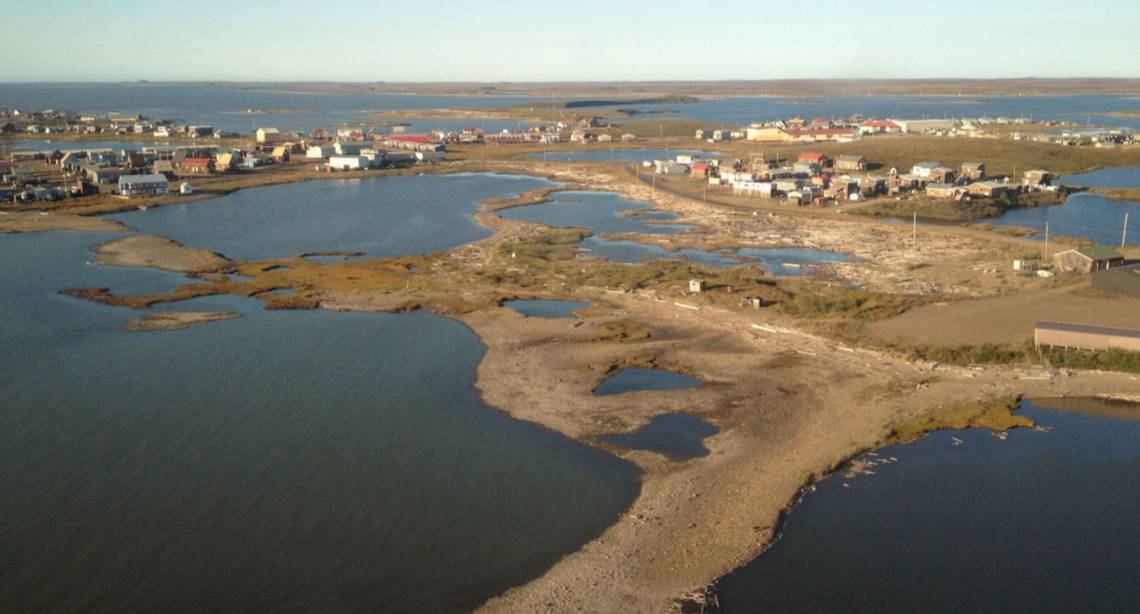
- Tuktoyaktuk: A Inuvialuit Community On The Arctic Coast. Pop 900
At the final stop at Tuktoyaktuk, one will be greeted not only by the Arctic Ocean but also by the world's largest pingo.
Along the route, drivers see wildlife, unspoiled landscapes, and indigenous culture. Keep one's eye's peeled for Arctic wildlife like Caribou and Arctic fox while en route.
There are even campgrounds along the highway that can accommodate RVs. Some Northwest Territories' territorial campgrounds include Nataiinlaii, Gwich'in, Jàk, and Happy Valley, located in Inuvik.
What To Know About Driving The Dempster Highway
The Dempster Highway is the only public highway crossing the Arctic Circle open year-round in North America. It is the first all-weather road to the Canadian Arctic Ocean. Starting out on the epic trip, pop in at the visitor centers in Dawson City and Inuvik and see the latest road conditions and any useful updates. Also note that as this is very remote, there may not be cell reception over much of the road.
The Dempster Highway is well maintained and can be driven on in any season. The best season for driving on it is June through to September - this is when the days are long and warm. The spring and fall can be problematic as rivers become impassible. Check with the Department of Transportation in Canada for any opening and closing dates of ferries and ice bridges.
- Best Season: June through September
- Speed Limit: 70 Kilometers Per Hour For much Of The Road
Is it easy to know when the journey ends - because that's where the road does at Tuktoyaktuk. If one has arrived in the summer, then dip one's toes in the Arctic Ocean - or take a splash if one can handle the cold cutting into one's body like daggers.
- Type: All Weather Road
Plan Ahead: The Dempster Highway Is Remote
The Dempster Highway is incredibly remote and so everyone needs to take the appropriate precautions and plan ahead. Make sure one's vehicle is dependable and one has all the pre-requisite roadside emergency kits like spare tires, food, batteries, first aid kit, extra gasoline, etc.
- Tip: Always Pass A Fuel Station With A Full Tank
There are a few fuel stops along the way - never pass a fuel stop with anything other than a fuel tank! One can fill up in Fort McPherson and at the halfway point at Eagle Plains.
At Eagle Plains, there is also a hotel and RV campground for those who would like to spend the night there. The felling points are at Fort McPherson, Inuvik, and Tuktoyaktuk (no propane in Tuk) in the Northwest Territories and at Eagle Plains in the Yukon.
There are also tours of the northern end of the highway for those not wanting to drive the road by themselves.