Big Bend National Park in Southwest Texas is the biggest national park in the state, covering approximately 800,000 acres. This expansive nature park boasts stunning desert landscapes, hiking trails for all experience levels, and incredible views of the Rio Grande.
Travelers looking to discover a different side of Texas should visit Big Bend by venturing to the far west and flying into El Paso. From there, they can rent a car or hire a driver and road trip to Big Bend National Park (approximately 6 hours) via artsy Marfa, charming Marathon, and Ghost Town Terlingua. Once in Big Bend National Park, there are numerous hiking trails to explore, with options for beginners, novices, and experienced trekkers. These are some of the top trails to check out in Big Bend.
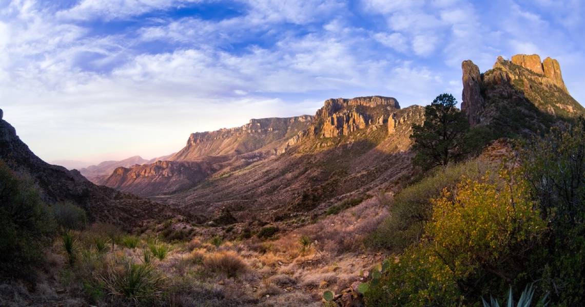
10 Lost Mine Trail
The Lost Mine Trail is the perfect choice for a half-day hike in Big Bend National Park. It’s got multiple viewpoints, so hikers who are short on time or less experienced can simply complete a portion of the trail, stopping at the lower viewpoint before descending back to the parking lot.
- Difficulty Level: Moderate
- Distance: 4.8 miles
- Elevation Gain: 1500 feet
9 Santa Elena Canyon Trail
An easy hike that is suitable for all experience levels and is great for families, the Santa Elena Canyon trail is one of the most iconic in the park. This trail begins at the mouth of the canyon and leads to the infamous spot where the canyon meets the Rio Grande. If travelers have seen photos of Big Bend National Park, they’re likely familiar with this image.
- Difficulty Level: Easy
- Distance: 1.4 miles
- Elevation Gain: 350 feet
8 Hot Springs Canyon Trail
The Hot Springs Canyon trail starts at a historic farmstead called Daniels Ranch. This moderately difficult hike offers scenic views of both the Chisos Mountains (the only mountain range entirely enclosed in a US National Park) and the Rio Grande (a river dividing the US and Mexico). Along this trail, there is a primitive hot spring with water temperatures around 105ºF where hikers can stop for a relaxing soak.
- Difficulty Level: Moderate
- Distance: 6.0 miles
- Elevation Gain: 720 feet
7 South Rim Loop
The South Rim Loop is one of the most strenuous hikes in the park and is a combination of multiple scenic trails, including the Laguna Meadow Trail and the Pinnacles Trail. There is significant elevation gain on this route, which takes trekkers through Boot Canyon and offers beautiful views of the canyon from the South Rim lookout point.
- Difficulty Level: Challenging
- Distance: 12.5 miles
- Elevation Gain: 3380 feet
6 Grapevine Hills, Balanced Rock Trail
Grapevine Hills, Balanced Rock, is a relatively leisurely hike with minimal elevation gain, making it suitable for the whole family. Although the latter part of the route is rocky, it’s worth attempting for the payoff of the views of Balanced Rock.
- Difficulty Level: Moderate
- Distance: 2.0 miles
- Elevation Gain: 330 feet
5 Dog Canyon Trail
This is a unique hike that takes travelers through Dog Canyon amid towering limestone walls. It’s a fairly flat route with minimal elevation gain. The trail is at a high risk of flooding under heavy rainfall, so when conditions are not sunny, check with a park ranger before hiking.
- Difficulty Level: Moderate
- Distance: 4.0 miles
- Elevation Gain: 50 feet
4 The Chimneys Trail
Travelers interested in Indigenous culture and history will want to put this hike at the top of their list. The chimney structures are visible from the outset, with a straight walk across the desert to reach them. At the chimneys, hikers can view pictographs (images painted on the rocks) and petroglyphs (images carved into the rocks) created by Native Americans. It’s critical to be respectful of the land and history; take nothing but photos and leave nothing but footprints.
The 4.8-mile hike is just to the chimneys and back, but if travelers feel adventurous, they can continue another 5.1 miles to Old Maverick Road.
- Difficulty Level: Moderate
- Distance: 4.8 miles
- Elevation Gain: 380 feet
3 Burro Spring Trail
The Burro Spring trail is an easy option for beginner hikers who still want epic views of the Chihuahuan Desert. The short trail takes around 1.5 hours to complete and traverses boulder fields of red rhyolite to reach a viewpoint. From the viewing spot, hikers can see the desert floor and Santa Elena Canyon.
- Difficulty Level: Easy
- Distance: 2.4 miles
- Elevation Gain: 300 feet
2 Pine Canyon Trail
Walk through the remnants of the last ice age at the Pine Canyon Trail, which has significant elevation gain. The elevation change is so drastic that hikers will head into alpine scenery, switching from desert landscapes to mountain views as they hike. This is a visually interesting hike that is one of the most remote in the park.
- Difficulty Level: Moderate
- Distance: 4.0 miles
- Elevation Gain: 1070 feet
1 Marufo Vega Trail
The challenging Marufo Vega Trail is named after Gregorio Marufo, who, at one time, grazed goats alongside the Rio Grande. This trail offers scenic views of the river and starts off moderately on a sandy trail before transitioning to a steep climb, leading to a plateau. Hikers enjoy cliff views of the Sierra del Carmen (in Mexico) and the river rushing below in the Boquillas Canyon.
- Difficulty Level: Challenging
- Distance: 12.6 miles
- Elevation Gain: 3270 feet
For more information on Texas, visit TravelTexas.com.